We have been back from Cuba for a month already. I finally feel ready to document our "Guide to Hike Around the Reservoir". Last year, I wrote about our hike to the reservoir and the rustic stick bridge. You can read about that here if you missed it.
This year we extended our hike to the stick bridge figuring out how to hike all the way around the reservoir. It takes about 3.5 hours of steady hiking from start to finish. The trails are rough with lots of climbing to keep it challenging. We wore shoes with good traction and packed plenty of water for this hike.
My husband sketched a map to provide an overview of our route. We also took photos so you can follow along while I point out key landmarks.
To get to the reservoir head off down the lane behind the hotel. This lane provides a shady shortcut to the bridge on the main road where you cross over to continue down the lane on the other side of the bridge. At the end of the lane, turn right across an open field past fenced gardens and houses until you reach another road (shown below).
Carry on down this road until the road splits. It is slightly shorter to stay to the right, but doesn't really matter as the road joins up again.Keep walking. Eventually you will see a huge earthen dam up ahead. The reservoir sits behind the dam.
As you approach the dam, the road forks. The left fork will take you up a steep road to the top of the dam. You want to take the right fork which takes you past some houses and an apiary where you can hear the hum of bees busy at work. Keep going towards the mountain.
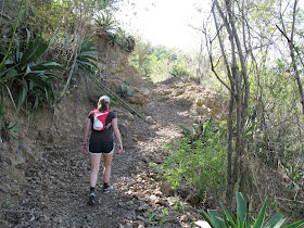
The trail winds up the mountain heading to the right away from the dam.
The trail continues upwards eventually winding back towards the dam.
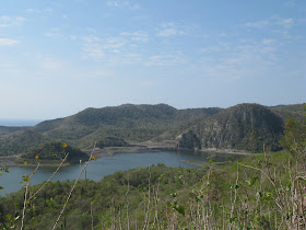
Take time to admire the views.When the trail levels off for a bit, you can catch your breath.
One of the hi-lights of this route is the twig bridge at the far East side of the reservoir. There is an alternate route across the dry gully below. We prefer to take our chances on the bridge. It seems stable enough.
If you're lucky, you might see a snake with black and white markings sunning on the trail.
Further along the trail (~15 mins), there is a small side trail leading to what we call "The Lookout" on the back side of the reservoir.
The views from The Lookout are truly spectacular - worth stopping.
After a few photos, make your way back to the main trail and carry on.
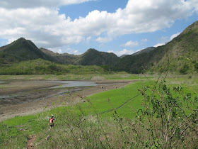
After climbing for a long stretch, you must now make your way down to the flood plains behind the reservoir. Cross over and pick up the trail on the other side of the river.
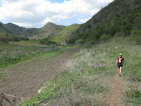
Follow a trail through the weeds on the flood plain. Keep going until you reach another dry river bed.
Follow the trail beside this dry river bed. Start on the right side, cross over then make your way along the left side.
In the photo below I am pointing to where you leave the river bed. I am pointing to this cluster of royal palm trees. Royal palms are large trees with straight trunks that look like they are made from cement.
Follow the trail through the royal palms to the start of another trail up the mountainside.
Turn left on the trail heading up the mountain.
Stick to the main trail. Do not take smaller trails as they pass through thorns and usually dead end.
When you reach this gate, pass through to the other side. Remember to close the gate.
Follow the main trail on the other side of the gate. It meanders up and down around another mountain peak.
On this trail, we realized we were heading in the right direction when we caught sight of the ocean. Keep following the trail along the fence line.
As we approached civilization again, we passed this water trough and some cows in a corral.
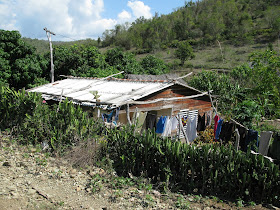
Soon after seeing the cows, you will pass some houses.
You will also pass through another gate on your way back.
When you end up at the 'waterfall', you're almost done.
This year the waterfall was completely dry. There was absolutely no water in the river above the waterfall.
Back at the start. You can see the earthen dam in the background in the photo below.
Our first attempt at hiking around the reservoir took 4 hours and 40 minutes with many wrong turns necessitating back tracking. Our second and third trips around the reservoir took 3 hours and 30 minutes at a steady pace with no mistakes.
We did take time to stop and admire flowers along the way. I especially liked these ones.
Hiking in the mountains in Cuba is fun. It is a proper workout. Be sure to let me know if you decide to follow this "Guide to Hike Around the Reservoir". I would love to hear how it goes.
Be the first to comment - click on No comments: below











Interesting hike - I'm sure your guide will be very useful - nice pictures.
ReplyDeleteThanks for all your hard work Beth.....It was great meeting your husband and you in Cuba. Thanks for leading us on this great hike.
ReplyDeleteNorm & Elijah
Good to hear from you Elijah. We enjoyed meeting you and your Dad as well. Thanks for joining us on this hike. It was fun.
Delete